Overview And Highlights
TRIP FACTS

" An authentic wilderness adventure in a remote area abundant with cultural heritage. "
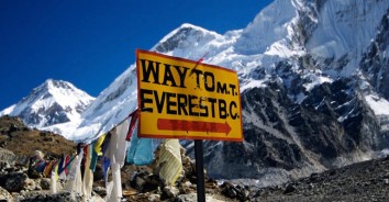
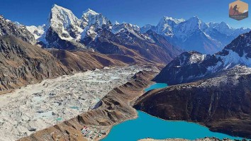
Annapurna Encounter offers a classic trek from Arun Valley to Everest Base Camp on the other side of Everest. You'll journey through high valleys in the Everest area, starting from Tumlingtar in the Arun Valley. Along the way, you'll be surrounded by towering peaks like Mt. Everest, Lhotse, Nuptse, Kwangde, Kangtenga, Tharmasarkhu, Mt. Pumori, and Mt. Ama Dablam. You'll have continuous views of these snow-capped mountains throughout the trip to Everest Base Camp & Kalapatthar .
The adventure begins with a scenic flight to Tumlingtar, a plateau above the Arun River, known for its warm tropical climate. From there, you'll head to Salpa village, crossing the high pass of Salpa at 3,349 meters and passing through beautiful rhododendron and pine forests. You'll visit Sherpa and Rai villages, including Gothe Bazaar, Salpa, Pangbung, Sonam, Guidel, and Bung. After crossing Ghaighat pass, you'll get closer to the Khumbu region, passing through Kharekhola and Surkhe before reaching Phakding village.
On the main trail to Everest Base Camp, you'll encounter other trekkers who have flown to Lukla. The journey takes you through traditional Sherpa villages, rich in culture and customs, as well as breathtaking scenery along the glacial Dudh Kosi river. You'll reach Namche Bazaar, the Sherpa capital, with modern amenities like hotels, lodges, restaurants, bakeries, cyber cafes, post offices, and banks.
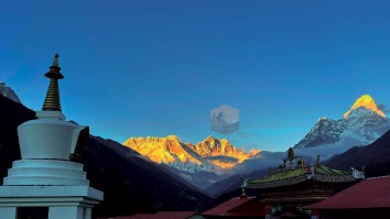
Continuing higher through serene woodlands of rhododendron, birch, pines, and firs, you'll enjoy views of snow-capped mountains every day. You'll visit the famous Tengboche monastery, surrounded by high peaks, before reaching Everest Base Camp, where you'll face the challenging Khumbu icefalls and glaciers. Finally, you'll climb Kalapatthar at 5,545 meters, offering mind-blowing views of the surrounding peaks, including a close-up of Mt. Everest.
After this unforgettable adventure from Arun Valley to Everest Base Camp with Kalapatthar, you'll return to Lukla and then to Kathmandu via a scenic flight, courtesy of Annapurna Encounter.
Highlights of Arun Valley Trek
- Trekking from Arun Valley to Everest base camp, the other side of Everest.
- On the least crowded area on the best of Solu & Khumbu region of Everest.
- Visiting Solu & Khumbu Sherpa’s village enriched with old tradition and culture.
- Pristine forest of rhododendron, pines, firs and birch trees with flora & fauna.
- Rich Buddhist culture, religion, monasteries in the shade of snow capped peaks.
- In the world’s highest Mt. Everest base camp with views of Khumbu icefalls.
Equipments
The next details will provide you with a basic understanding of what you should carry for the trek. It's crucial not to overlook the necessary items, as they will impact your comfort and safety during the hike. It's just as vital not to weigh yourself down with unnecessary gear during the trek.
- A pair of half-golves
- A pair of Woolen shocks
- A wool jacket or pullover, Water and Windproof shell jackets
long sleeve t-shirts - Windproof and Waterproof Trousers (warmer), Comfortable trekking pants
- Water Trekking Boots/ Pair of sandals
- First Aid kits and Medicine
- Backpack with rain cover
- Water Bottle
- Headlamp or torch
- Sunscreen / Sunglasses / Sunhat
- Sleeping bag
- Trekking Poles
- Chapstick
- Camera & Batteries
- Power adapter and chargers
- Travel Towel
- Toiletries
Itinerary Expand All Close All
As per the flight to Tumlingtar, our AE staff transfer you to domestic Kathmandu Airport for a scenic flight of 40 minutes to Tumlingtar, with great views of snow capped peaks from Langtang including Mt. Everest, Makalu & Mt. Kanchenjunga, on reaching at Tumlingtar town, which is above Arun River with warmer sub-tropical temperature walk to the town area and transfer to lodge for overnight with rest of day at leisure to explore this nice town like village.
Food
BLD
Accomodation
Lodge
Elevation
518
A short walk today on the warmer area walking on the shore and river bed of
Arun River fed from the glacier of Makalu, Barun and mountain in Tibet, morning walk is pleasant walking on the shore of the river and into patch of small forest and passing several isolated farm villages of Rai tribes and then leading to cross a bridge over Arun River and to Katikeghat for overnight stop, here due to less trekkers might accommodate in tents with simple Nepali meals, with time in the afternoon for a splash in the cool river.
Food
BLD
Accomodation
Lodge
Elevation
840
From this small farm village leaving the river behind with climb over a hill top with great views of Arun valley, the walk leads to winding path through many scattered farm villages where rows of mandarin oranges are grown in abundance around this area, the walk leads towards north into rain forest and reaching Baluwabesi villages of Brahman, Chettri and Rai people, and then arriving at Gothe Bazaar for overnight stop ( here again might use tents for night rest with simple Nepali meals) Gothe a small farm village, famous for Rudrakchhhaya (Hindu’s holy beads).
Food
BLD
Accomodation
Lodge
Elevation
800
The walk today leads through terrace land with rice paddies, citrus fruits, banana groves etc. sparsely populated by Rai and Sherpa people, local produces Nepali paper with local plants Lokta (Dampne papaerius). Trail leads upwards on the slow walk gaining more altitude leaving the warmer area for cooler region at Salpa phedi the base of the hill of Salpa and the pass with few local lodges for overnights.
Food
BLD
Accomodation
Lodge
Elevation
2415
Morning starting with a steep uphill climb through dense alpine woodlands of bamboo, rhododendron, oaks, hemlock and pines trees the walk passes few cattle herders shelter and camps in between forest surrounding and then after hard climb of the day reaching a small place at Guranse meaning “with rhododendron” for the night stop here might have to take shelter in tents and simple camping meals.
Food
BLD
Accomodation
Lodge
Elevation
3075
From this thick forest line starting morning walk with a climb after an hour uphill walk reaching at Salpa pass of 3,349 meters altitude, with a large Buddhist chortens marking this scenic pass and from here a slow start of Sherpa culture influence, after a nice break here on the long downhill to reach at Sonam a Sherpa village for lunch after a long morning walk, from here on the gradual winding path to reach at Guidel large spread out Rai village for overnight stop in local simple lodge.
Food
BLD
Accomodation
Lodge
Elevation
1640
Starting the morning walk on a nice pleasant trail to cross a bridge over Hinku river which flows from the Mera peak area, after the bridge a short climb to another large Rai village at Bung, this rice growing area is one of the most fertile area of eastern Nepal, with Sherpa residing on much higher region. From here an hour or more of good climb through farm lands reaching at Khiraule a small village and cooler than the villages of Bung and Guidel.
Food
BLD
Accomodation
Lodge
Elevation
2360
From this nice quaint village morning walk leads to a steep climb into cool forest of rhododendron, pines, oaks and hemlock trees to reach at Surki-la also called as Ghai-Kharka pass a narrow gorge like place and quite dark with thick forested area, the pass is marked with few prayer flags and prayer signs and monuments, from here leading downhill on the steep path to Ghai-Kharka for overnight stop,
a small farming and cattle herders place with few small and simple tea houses serving as lodge for trekkers.
Food
BLD
Accomodation
Lodge
Elevation
2450
After a nice quiet time morning leads to downhill to cross a bridge over Hinku Khola which later joins Dudh Kosi river, after the bridge with a steep climb heading higher to reach a small settlement at Kharte with Sherpa farmers.
With a nice break probably lunch here and with another few hours of afternoon walk to Pangbung village for overnight stop, a nice moderate size village of the Sherpa.
Accomodation
Lodge
Elevation
2670
From here onwards into Khumbu region after being around Arun Valley and short time in Solu area, walk leads to a small climb on the wide trail above the village of Khare khola leading through woodland of oak, rhododendron and Dhaphne bushes (Nepalese rice paper plant). Walk carries on to reach our overnight stop at Bupsa village a small Sherpa place with nice comfortable lodge for overnight stop, from here onwards with good lodge to stay as this trail joins the Jiri route.
Food
BLD
Accomodation
Lodge
Elevation
2250
Morning walk with a climb on the winding trail into a cool alpine forest passing several farm lands and villages and to a Pyuin village (Paya) stopping here for lunch break here the temperature gets cooler on reaching higher Khumbu area, from here walk is pleasant with few ups and downs but on gradual wide path reaching the top ridge of Surkhe above Lukla town.
From here descend towards Surkhe village for overnight stop, in the first village of Khumbu region after being in Solu area for several days.
Food
BLD
Accomodation
Lodge
Elevation
2295
From Surkhe walk leads to an uphill on the winding path passing farm houses and terraces to Ghai Kharka or Muse village a large scattered village with high school and a monastery, from here joining the trail coming from Lukla, where you meet the fresh trekkers taking a flight to Lukla from Kathmandu, and then walk for an hour with gradual winding trail with few ups and down passing many smaller villages and farm fields with view of Kusum Kanguru and Kwangde peaks going around clockwise on Buddhist mani (prayer) walls and monument to reach at Phakding village for the first overnight in Khumbu area. Phakding located by the glacial Dudh Kosi River.
Food
BLD
Accomodation
Lodge
Elevation
2650
Starting the fresh morning walk with pleasant uphill following the Dudh Kosi River and re-crossing the same river few times as the walk progress to reach at a nice Monjo village with views of Tharmasarkhu peak and the sacred peak of Khumbila at 5,865m (the patron God of Khumbu area) from here heading down to the entrance of Sagarmatha National Park after registration of Park & TIMS permits (Trekking Information Management System) which all trekkers must have to travel in the Nepal Himalayan region, here with information centre which is interesting to learn of the Khumbu area and its mountains and culture.
From here leading to cross a bridge over Dudh Kosi and arriving at Jorsalle the last village before Namche Bazaar of 2-3 hrs walking distance, stopping here probably for lunch break, afternoon walk leads on the river valley for sometime on reaching the last high bridge an uphill climb for 1-2 hours to reach our overnight destination at Namche, walking on the winding uphill through nice pines, firs and rhododendron woodland, chances of seeing some wildlife like Impeyan pheasant Danfe (Lopoforous) a colorful big bird which is Nepal national bird.
After a tiring climb finally reaching at Namche Bazaar with colored roofs houses set in huge U shaped with views of Kwangde Himal and Tharmasarkhu peak, here check into nice clean comfortable and cozy lodge for overnight stop for 2 nights.
Food
BLD
Accomodation
Lodge
Elevation
3440
A full rest day here for acclimatization at this high altitude of 3,440 meters before heading higher destination, Namche bazaar full of shops, stores, pubs and restaurants, post office, banks, cyber café with fresh bakery, this place is flooded with locals for shopping fresh supplies in Saturday market. Namche offers places for short or day hike to neighboring scenic areas up to Syangboche small airstrip and towards famous Everest View Hotel, Khunde and Khumjung village on the wide glacial valley beneath Mt. Khumbila or long hike to Tamo and Thame towards west, but the best thing is to 30 minutes climb the top ridge of Namche for aerial view of Namche bazaar and the surrounding mountain panorama with first view of Mt. Everest, Lhotse, Nuptse and the majestic peak of Ama Dablam, Kangtenga, Tharmasarkhu, Kwangde and Pachermo towards west, here visit the museum with information on flora / fauna, Sherpa traditions, culture and of mountaineering history of Khumbu area.
Food
BLD
Accomodation
Lodge
Elevation
3440
After a fine rest in Namche morning walk leads to a small climb at the top ridge and then on the gentle winding trail with few ups and down along with the great superb views of Mt. Everest and adjoining mountains, walk leads further with constant scenery of mountains rivers and dales in the forested area of alpine vegetations, after few hours, descending to Imjatse River at Phunge Tenga a small place for lunch stop located in the midst of conifer woodland.
From here 2 hours climb through the dense tree lines of pines, firs and rhododendron with awesome views of snow clad peaks and finally reaching the picturesque spot at Tengboche Monastery area with grand panorama of mountains that encircles this small place and towards north view of Mt. Everest and the stunning close face of Mt. Ama Dablam, with afternoon free to visit this interesting monastery and the museum.
Food
BLD
Accomodation
Lodge
Elevation
3867
From Tengboche walk continues with a downhill through nice pleasant forest passing lovely place of Deoboche with Buddhist nunnery area and rows of prayer walls and then leading to cross a bridge over raging deep Imjatse river, after the bridge a gradual climb with awesome post card view of Ama Dablam peak and then reaching Pangboche village, this is the last permanent Sherpa village of this area, further on with only temporary settlement to cater the needs of the trekkers.
After Pangboche walk is moderate and then a steep climb up to Somare a small settlement with lodge and shops, a popular place for lunch spot on route Pheriche and Dingboche, with a lunch break here afternoon can be quite chilly with cold breeze and wind from here onwards, walking slowly on the gentle up with close view of Ama Dablam after few hours of good walk leading to a cross a bridge and with steep up for an hour and then a pleasant walk to Dingboche for overnight stop in this beautiful Imjatse valley with views of Island / Imjatse peak towards East of the valley along with Nuptse, Lhotse, Tawache and the North Face of Ama Dablam which looks totally different from this northern side.
Food
BLD
Accomodation
Lodge
Elevation
4430
With a nice time at Dingboche feeling refresh, from here getting closer to our destinations, starting the morning walk with a slow climb to the first top ridge above Dingboche with Buddhist monuments and prayer flags with grand views of surrounding snow capped peaks as far to Mt. Makalu in the east, and then on the pleasant trail for few hours with gradual uphill looking down at Pheriche and the valley beneath the peaks of Tawache and Cholatse, and with first view of Mt. Pumori and reaching at Thugla for lunch stop, a small place with 2-3 small lodges located at the end of Khumbu glacier where it melts and starts into a raging Dudh Kosi River. After a nice break a steep up for an hour or less on the ridge top lined with tombs and memorial of unfortunate climbers on the mountaineering expeditions on Everest and other mountains of Khumbu area, from here a nice walk with slight up to reach at Lobuche for overnight halt with views of Nuptse and Changtse peak which lies into Tibet side over Lho la mountain ridge.
Food
BLD
Accomodation
Lodge
Elevation
4840
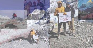
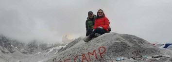
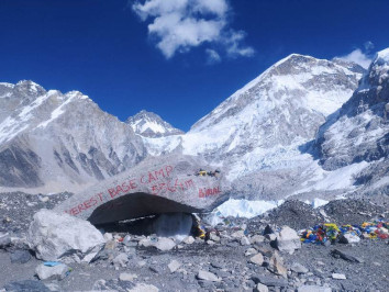
Today towards our final destination and the highlight of this wonderful trip to Everest Base Camp, starting earlier to reach base camp and back to Gorakshep on time, as this will be one of the longest day trek heading North slowly past the metrological glass Pyramid station nearby, managed by Nepal and Italy government geologist, and then the walk leads through rocky moraine above Khumbu glacier to reach Gorakshep after 2-3 hours of walks, Gorakshep located on route Everest Base Camp beneath Kalapatthar rocky hill and towering Mt. Pumori with 3-4 lodges, after a break here continue walk towards east for few hours on the moraine of rocks with few hard ground and then on the icy glacier reaching to our goal at Everest base camp with awesome views of Nuptse, Lhotse, Changtse, Lho-la Lingtren and of Pumori Everest is hidden behind these high peaks and then looking at notorious Khumbu ice falls, after a wonderful moment feeling high spirit on reaching the highlight of this trip, base camp is flooded with expeditions camps during high season of April to May.
After a time here return back to Gorakshep for overnight stop after 5-6 hours of steady and tiring walk due to high altitude.
Food
BLD
Accomodation
Lodge
Elevation
5360
Early morning 2 hours hike to the top of rocky summit of Kalapatthar at 5,545 meters the highest spot of this trip offering glorious views of surrounding mountains that encircles this amazing spot with Mt. Everest at near distance after an enjoyable and hard climb return trek back to Gorakshep and continue walk downhill to Pheriche reaching back at Thugla and from here the route diverts towards the valley floor on almost flat ground walking for an hour more on this windy valley reaching at Pheriche for overnight stop. Pheriche with views of surrounding peaks and with medical facilities at HRA post (Himalayan Rescue Association).
Food
BLD
Accomodation
Lodge
Elevation
4240
From Pheriche after the base camp and climb of Kalapatthar today’s walk is easier on the downhill path with few ups on route, walk leads to cross the river and with 40 minutes climb to a ridge and then downhill to Pangboche and then back to green vegetation and tree lines after the bridge, from here leading to a climb for few hours to Tengboche for overnight stop.
Food
BLD
Accomodation
Lodge
Elevation
3900
Retrace the journey back to Monjo on loosing much altitude through Lobesa, Shanasa after a short climb from the river at Phungetenga and then to Namche Bazaar, after a rest here continue walk downhill to river bed and after crossing two bridges back at Monjo for overnight stop.
Food
BLD
Accomodation
Lodge
Elevation
2860
Today the last leg of the trek with pleasant walk on the winding trail passing several villages of Benkar, Toc-toc and Phakding and then Ghat, from Choplong village where the trail from Jiri joins with the last climb for an hour or more to reach at Lukla for last dinner and overnight with the guides and porters.
Food
BLD
Accomodation
Lodge
Elevation
2830
As per the flight time to Kathmandu, a short walk to Lukla airport terminal in the early morning, on boarding the smaller plane 30 minutes of sweeping flight with parallel views of mountains all the way to Kathmandu, at Kathmandu transfer to hotel after a short drive around Thamel area, with whole day free as per the time of return flight from Lukla.
Food
Breakfast
Accomodation
Hotel
Elevation
1350
Services Included on Price
Cost Includes
-
Accommodation
- Basic tea houses/guesthouses along the trek (twin-sharing, simple rooms)
-
Transport
- Local bus Kathmandu → Tumlingtar
- Domestic flight Lukla → Kathmandu (regular airline, economy class)
- Local vehicle transfers in Kathmandu
-
Meals
- Not included – trekkers pay directly in tea houses for flexibility
-
Guide & Porter
- Licensed English-speaking trekking guide
- No porter (can be arranged at extra cost)
-
Permits & Fees
- Sagarmatha National Park entry permit
- Khumbu Pasang Lhamu Rural Municipality permit
- TIMS card
-
Extras
- Basic first aid kit with the guide
- Pre-trek briefing
Cost Excludes
-
Meals during trek & in Kathmandu
-
Accommodation in Kathmandu before/after trek
-
Porter service (optional at extra cost)
-
Personal trekking equipment (sleeping bag, down jacket, poles, etc.)
-
Hot showers, Wi-Fi, battery charging in tea houses (paid locally)
-
Travel insurance (mandatory, covering high altitude & evacuation)
-
International flights & Nepal visa fees
-
Alcoholic beverages, bottled water, snacks
-
Tips for guide and driver
-
Extra costs due to Lukla flight cancellations, weather delays, strikes, or natural disasters
Standard Package Service Includes
-
Accommodation
-
2 nights in a 3★ Kathmandu hotel (with breakfast)
-
Standard tea houses/lodges during trek (twin-sharing)
-
-
Transport
-
Private jeep/car Kathmandu → Tumlingtar
-
Domestic flight Lukla → Kathmandu (regular airline, economy class)
-
Private airport transfers in Kathmandu
-
-
Meals
-
Breakfast in Kathmandu
-
Three meals per day during trek (breakfast, lunch, dinner with tea/coffee)
-
-
Guide & Porter
-
Experienced licensed trekking guide
-
Porter service (1 porter for every 2 trekkers, baggage limit 15–20 kg)
-
-
Permits & Fees
-
Sagarmatha National Park entry permit
-
Khumbu Pasang Lhamu Rural Municipality permit
-
TIMS card
-
-
Extras
-
Airport pick-up/drop-off
-
Basic medical kit with oximeter
-
Assistance in case of flight delays
-
Standard Package Service Excludes
-
Lunch & dinner in Kathmandu (except where mentioned)
-
Personal trekking gear (can be rented in Kathmandu)
-
Hot showers, Wi-Fi, charging during trek (paid locally)
-
Travel insurance (mandatory)
-
International flights & Nepal visa fees
-
Alcoholic beverages, bottled water, snacks
-
Tips for guide, porter, and drivers
-
Extra accommodation due to delays (weather or personal reasons)
-
Costs due to unforeseen events (natural disasters, political unrest, etc.)
Luxury Package Service Includes
-
Accommodation
-
2 nights in a 4–5★ luxury hotel in Kathmandu (with breakfast)
-
Best available lodges/tea houses during trek (upgraded rooms, attached bathrooms where available)
-
-
Transport
-
Private deluxe jeep Kathmandu → Tumlingtar
-
Domestic flight Lukla → Kathmandu (option for helicopter return)
-
Luxury airport transfers in Kathmandu
-
-
Meals
-
All meals during trek (menu variety available)
-
Breakfast in Kathmandu
-
Welcome and farewell cultural dinners in Kathmandu
-
-
Guide & Porter
-
Highly experienced licensed trekking guide with high-altitude expertise
-
Porter service with higher baggage allowance (20–25 kg per porter)
-
Insurance for trekking staff
-
-
Permits & Fees
-
Sagarmatha National Park entry permit
-
Khumbu Pasang Lhamu Rural Municipality permit
-
TIMS card
-
-
Extras
-
Trekking gear on loan (sleeping bag, down jacket, walking poles)
-
Cultural show in Kathmandu
-
Emergency helicopter coordination support (insurance required)
-
Oximeter and daily health monitoring
-
Luxury Package Service Excludes
-
International flights to/from Nepal
-
Nepal entry visa fees
-
Comprehensive travel insurance (high altitude & evacuation)
-
Personal expenses: shopping, laundry, souvenirs, phone calls, etc.
-
Alcoholic beverages, specialty meals not in package
-
Tips for guide, porter, and driver (customary)
-
Optional upgrades (full helicopter return, single-room supplement in lodges)
-
Extra expenses due to Lukla flight cancellations, weather delays, or political unrest
Arun Valley to EBC Trek Altitude Profile
FAQs
The trek usually takes around 20-25 days, depending on the route and itinerary. However, it can be customized to fit the needs and preferences of the trekkers.
The best time to go on the Arun Valley to Everest Base Camp Trek is from March to May and September to November when the weather is mild, and the skies are clear. The monsoon season (June to August) and the winter season (December to February) are not recommended for trekking in this region due to the heavy rainfall and extreme cold temperatures.
The Arun Valley to Everest Base Camp Trek is a challenging trek that requires good physical fitness and endurance. The trek involves steep ascents and descents, crossing high mountain passes, and walking for long hours each day. Altitude sickness is also a concern, as the trek goes up to an altitude of 5,550 meters at the base camp.
Yes, trekkers need to obtain permits from the Nepal government to go on the Arun Valley to Everest Base Camp Trek. The permits include the Sagarmatha National Park Permit and the Khumbu Pasang Lhamu Rural Municipality Permit. These permits can be obtained from the Nepal Tourism Board in Kathmandu or from local trekking agencies.
The accommodation on the trek varies from basic tea houses to more comfortable lodges. The tea houses offer shared dormitory-style rooms with common bathrooms and toilets, while the lodges offer private rooms with attached bathrooms. The accommodation is basic but clean and comfortable, and most of them provide hot showers and Wi-Fi facilities.
The food on the trek is usually Nepali, Tibetan, and Indian cuisine, with some western options as well. The meals are cooked fresh and are usually vegetarian. However, meat options are also available in some places. The tea houses and lodges also offer snacks and beverages like tea, coffee, and hot chocolate.
.jpg)