Overview And Highlights
TRIP FACTS

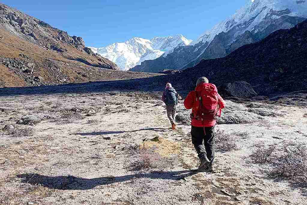
Trekking Around Kanchenjunga near Tibet with reliable service of Annapurna Encounter leading to close view of world’s 3rd highest Mt. Kanchenjunga at 8, 586 meters / 28,169 ft high, that straddles the border with Nepal / Sikkim of North East India, the word Kanchenjunga from Tibetan meaning the “five jewels peak” and it always good to know the local meaning of the place on trek.
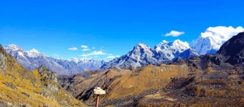
Trekking Around Kanchenjunga near Tibet with Annapurna Encounter starts with a scenic panorama flight from Kathmandu to far east town of Bhadrapur near India border, offering tremendous mountains views during quarter of an hour from Gaurishankar, Mt. Everest and of Mt. Kanchenjunga massive range of peaks including Khumbakarna Himalayan mountain range & Mt. Makalu, after the pleasant ride with a drive towards mid hills of Sukhetar at Taplejung village after spending the night in a nice Tea Garden town of Ilam. Starting the trek towards North East to visit first on the least visited area at Walungchung-Gola of strong Tibetan influence in culture, traditions, religion and way of life as this place lies close to Tibet Eastern border, with an interesting an impressive time here crossing over high pass at 5,160 meters of Lumba- Sumba ridge top, on the highest spot of this classic journey offering awesome panorama of world’s highest peaks of Mt. Everest, Makalu towards North West and close views of Mt. Kanchenjunga and Khumbakarna range of mountains and then heading back via alternative route towards warm Arun Valley and Makalu area at Tumlingtar for the flight back to Kathmandu after an interesting time on this unique classic trekking Around Kanchenjunga near Tibet with Annapurna Encounter.
Highlights Of Around Kanchenjunga Trek Near Tibet
-
trekking around worlds’ 03rd highest Mt. Kanchenjunga massive range
-
visiting remote cultural, traditional villages near to Tibet frontier
- in enchanting alpine forest surrounding with tall rhododendrons trees
- starting from sub- tropical, alpine mid hills to arctic climate and terrain
Equipments
The next details will provide you with a basic understanding of what you should carry for the trek. It's crucial not to overlook the necessary items, as they will impact your comfort and safety during the hike. It's just as vital not to weigh yourself down with unnecessary gear during the trek.
- A pair of half-golves
- A pair of Woolen shocks
- A wool jacket or pullover, Water and Windproof shell jackets
- long sleeve t-shirts
- Windproof and Waterproof Trousers (warmer), Comfortable trekking pants
- Water Trekking Boots/ Pair of sandals
- First Aid kits and Medicine
- Backpack with rain cover
- Water Bottle
- Headlamp or torch
- Sunscreen / Sunglasses / Sunhat
- Sleeping bag
- Trekking Poles
- Chapstick
- Camera & Batteries
- Power adapter and chargers
- Travel Towel
- Toiletries
Itinerary Expand All Close All
As per the flight time to our destination transfer to Kathmandu domestic airport for the super scenic flight to Bhadrapur with awesome panorama views array of snow capped mountains from Ganesh-Langtang-Jugal Himal, Gaurishanker, Numbur and Mt. Everest with Nuptse, Lhotse and as far to Kanchenjunga and Makalu range, after 40 minutes reaching at Bhadrapur on the far south east of Nepal close to India border and in sub-tropic climate, from here join our trekking staff for the drive to a nice Tea Garden town at Ilam Bazaar for overnight stop on this mid hills area, where its cooler.
Food
BLD
Accomodation
Lodge
Elevation
1460
After an interesting time at Ilam with its sea of tea garden, morning few hours of scenic drive leads to many farm villages and towns and then crossing the Kabeli Khola (Small River) on the jeep rough road reaching at
Sukhetar village in Taplejung after a drive of four hours, from Suketar starting the first walk of this wonderful journey heading downhill with short ups in between to reach a small farm village of Mitlung at 921 meters, where temperature is quite warm with rice paddies grown around this low altitude.
Food
BLD
Accomodation
Lodge
Elevation
921
Following long downhill path along Tamor River with few short ups and downs to Sinwa village, from here continue descends to Tawa village and then crossing several streams to reach a small green valley after passing few scattered farm villages and reaching at our overnight camp at Chirwa which is a moderate size village with mix tribes of Rai (Kirat tribe) Magar, Tamang and Hindu Chettries, Brahmins and dalits.
Food
BLD
Accomodation
Lodge
Elevation
1270
From Chirwa morning walk heading towards Sukathum village, on reaching a small woodland by the river bank with mix terrains landscapes and cultivation of cardamom fields in complete shade of a dense tree lines, then leading higher on cultivated farm fields and short descend to overnight camp at Lungthang a small farm village, from here the air gets cooler and change in people culture and custom of Tibetan influence.
Today walk leads to one of the highlight of this trip at Holung located on the trail to Tibet, and a large village of this surrounding high mountainous cold area, although a long walk of mixed variations with gentle slope to downhill and steep ups and into a lovely alpine forest of beautiful rhododendron, oaks and pine trees, the walk leads downstream to Yangma Khola and then our direction changes heading towards North West into Tamar Khola at about 2,800 meters to follow a wide trail on the winding up to reach at Walangchung - Gola also known by Holung name, here we will have 2 nights stops to explore this interesting and impressive high remote village.
Food
BLD
Accomodation
Lodge
Elevation
3200
A place for rest and optional walk around this impressive village of stone built houses and farms, the people here are of Bhotia’s tribe with strong Tibetan influence in al nature, from Tibetan Buddhism religion, culture and way of life. The villagers do trade and barter with Tibet still as this was a caravan route bringing goods from both side in exchange for salts and Tibetan / Chinese goods to rice, spices and pulses and other food stuff from Nepal. Here visit the village and explore the local old monastery.
Food
BLD
Accomodation
Lodge
Elevation
3200
Enjoying the time at Holung village around Wangchungo-la area, morning walk leads to Tamor Khola and reaching a river confluence of Dinsangba river which later joins the big Tamor river way down, after crossing a small wooden bridge with a climb nearly half day of 3-4 hours to Lumba Sumba ridge top through forested area of rhododendron, pines, oaks and magnolia trees and then heading back with downhill to Dinsangba Khola again following upstream into woodlands and with a climb again passing several yak grazing pasture known as kharka and to large green valley, and continue over a black rock band to reach another valley to end the day walk with overnight stop on the meadows.
Food
BLD
Accomodation
Lodge
Elevation
4450
Starting the morning walk earlier as today a long day trekking of nearly eight hours on the faint trail heading North West of a stream flowing from a high rocky cliff edge, after few hours of nice walk coming to an icy pond and then leading to a climb of this plateau northern side to head beyond to ridge top of Lumba Sumba-la pass at 5,135 meters the highest spot of this remarkable journey and a wonderful experience to achieve this high elevation. From the top looking around eastern Himalayan panorama from Mt. Everest, Lhotse, Makalu, and Khumbakarna Himal with massive range of Mt. Kanchenjunga, after a grand time heading to another ridge that line this high hills contouring to reach Lumba Sumba La again but different to offering same views of snow clad mountains of Mt. Kanchenjunga & Jannu Himal to the east with Makalu towards North West.
Finally on the long downhill loosing at about 600 meters descend to reach a wide valley and to camp on the large pasture field at 4,500 meters altitude the highest camping spot of this trip as well.
Food
BLD
Accomodation
Tented Camp
Elevation
5160
A nice feeling to be in complete wilderness away from villages and human settlement for few days, from here walking to much warmer area on the gradual descend and then with a climb for a while and back to normal walk with few short ups on route and then into a alpine woodland and finally ending the day walk of near five hours at Thudam a nice village with Tibetan influenced villagers as in Holung village, a moderate size village of more than twenty houses built with stone and fine pine woods.
Food
BLD
Accomodation
Lodge
Elevation
3600
After an interesting and nice time in this remote village, walk starts back into dense forest to camp at Kharka (Sheppard’s shelter), at first following the path through thick vegetation of bushes and tall tree lines and then heading downhill to a river and with small climb in between but more or less on the downhill walk to reach an isolated yak herders camp at Kharka for overnight stop.
Food
BLD
Accomodation
Lodge
Elevation
2850
From here another long day walk of near seven hours, morning starts with a short climb to a small village on the mid-hills just above Arun River from this place another three hours leading to climb to a small pass and then a long descend on the muddy and wet trail to reach Arun River with thick vegetation of bamboo stalks and prickly bushes, and then walking across a bridge, and then a steep uphill walk of about 500 meters long climb to reach the overnight camp at a nice village of Lhomi village and Chyamtang which is close together.
Food
BLD
Accomodation
Lodge
Elevation
2190
Morning walk on moderate terrain with few short ups and downs (which is famous and popular word in Nepali) walking on main path passing many scattered farm hamlets and villages and reaching near to this village a large landslide which damaged many houses and primary schools in monsoon season in the year 2012, after a nice trekking of about six hours reaching at Hongaon for overnight stop.
Food
BLD
Accomodation
Lodge
Elevation
2320
From this small neat village, morning walk leads to much warmer places entering sub-tropical country zone, journey continues following the Arun River downstream which is fed by the glacier of Mt. Makalu and Barun Himal flowing right near Tumlingtar to join Sun Kosi near the flatland of Nepal Terai, walk leads across many farm lands and terraces, villages and reaching our overnight camp at Hatiya village, a popular village located on Nepal / Tibet trade route.
Food
BLD
Accomodation
Lodge
Elevation
1585
After this interesting village of Hatiya walk leads to more warmer area which is pleasant to trek on shorts and T shirts, encountering many small farm villages and cultivated terraces with rice paddies depending upon the season as rice is planted in wet monsoon season and harvested in autumn season, walk continues to follow the main trail for about five hours on good nice path following for sometime upper Arun River and then on the downhill with short ups to reach the overnight stop at Gola farm village.
Food
BLD
Accomodation
Lodge
Elevation
1128
From here onwards villages of mixed tribal people of Kirat Rais, Magar, Gurung, Chettries, Brahmins and few Dalits people, the walk is interesting meeting friendly villagers along this nice pleasant walk passing many rural and nice villages and finally arriving at Gadhi-danda village for overnight stop offering grand views of Jaljala rocky and snow peaks near Milke danda area.
Food
BLD
Accomodation
Lodge
Elevation
1180
Today the last leg and the final trek of this trip to Num village, after leaving Gadhi-Danda village leading to a descend into farm fields and terraces for some hours and passing many villages on this morning walk, and then ending the day with the final trekking at Num village slowly developing into town with the construction of motor road during this past few years.
Num a fine large village situated on a ridge top overlooking views of hills to Makalu area and of Jaljala Himal towards north.
Food
BLD
Accomodation
Lodge
Elevation
1560
After a wonderful time in the high hills and mountains and in rural villages, from here with a drive on rough jeep road, but interesting going through many farm villages and with beautiful scenery of surrounding green landscapes and snow capped peaks in the distance, after few hours of drive reaching at a large town of Khadbari the major town and headquarter of Sanka Sambua district in Makalu region. From here an hour of descend brings back to Tumlingtar in the comfort of nice simple lodge.
Food
BLD
Accomodation
Lodge
Elevation
540
As per the flight time to Kathmandu, a short walk to Tumlingtar airport terminal in the morning, on boarding the plane 40 minutes of sweeping flight with parallel views of mountains all the way to Kathmandu, at Kathmandu transfer to hotel after a short drive around Thamel area, with whole day free as per the time of return flight from Tumlingtar.
Food
Breakfast
Accomodation
Hotel
Elevation
1350
Services Included on Price
Cost Includes
- Airport pickup and drop-off
- Teahouse accommodation during the trek
- Three daily meals (breakfast, lunch, and dinner) throughout the trek
- Round trip flight ticket from Kathmandu to Bhadrapur
- Hotel accommodation in Illam on twin sharing basis with full board meals
- Local jeep transportation from Bhadrapur to Taplejung and from Khanidingbe to Bhadrapur
- English-speaking trekking guide with insurance, transportation, food, and accommodation
- All necessary trekking permits (TIMS Card, Kanchenjunga Conservation Area Project, and Restricted Area Permit)
- Use of a sleeping bag and duffel bag (if required, to be returned after trip completion)
- Daily seasonal fresh fruits after dinner
- First aid kit carried by the guide (including an oximeter to measure oxygen and pulse levels at high altitude)
- All applicable government and local taxes.
Cost Excludes
- Personal expenses (WiFi, Phone calls, Laundry, Bar bills, Battery Recharge, Water, Shower, and Tea / Coffee)
- Other costs not mentioned in 'Cost Includes' section
- Travel and Rescue Insurance
- Tips for Guides, Porters, and Drivers
Around Kanchenjunga Trek near Tibet Altitude Profile
FAQs
The Kanchenjunga Trek is a popular trekking route in Nepal that takes you through the foothills of the Kanchenjunga massif, which is located near the Tibet border.
The length of the trek depends on the route and itinerary you choose. The standard route takes about 20-25 days to complete.
The best time to go on the Kanchenjunga Trek is from September to November and from March to May, when the weather is clear and dry. However, the trek can also be done in other months with proper preparation.
Yes, a permit is required for the Kanchenjunga Trek. You will need to obtain a TIMS card, a Kanchenjunga Conservation Area Project (KCAP) permit, and a Restricted Area Permit (RAP).
The Kanchenjunga Trek is considered to be a challenging trek due to its high altitude and rugged terrain. It is recommended for experienced trekkers who are in good physical condition.
Accommodation options on the Kanchenjunga Trek include teahouses, guesthouses, and camping. Teahouses are the most common type of accommodation and provide basic amenities such as a bed, blankets, and meals.
You should pack warm clothing, a good quality sleeping bag, sturdy trekking boots, a waterproof jacket, a hat, gloves, sunglasses, sunscreen, insect repellent, a water bottle, and basic medical supplies.
The food on the Kanchenjunga Trek is typically Nepali and Tibetan cuisine, with options such as dal bhat (rice, lentils, and vegetables), momos (dumplings), and thukpa (noodle soup). Teahouses also offer Western-style food such as pasta and pizza.
Yes, altitude sickness is a concern on the Kanchenjunga Trek due to the high altitude. It is important to acclimatize properly and drink plenty of water to prevent altitude sickness. It is also recommended to carry a first-aid kit and an oximeter to monitor oxygen and pulse levels.


