Overview And Highlights
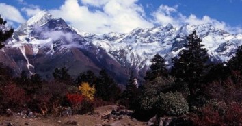
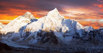
Jomolhari Loop is the shortest of the Jomolhari trekking routes, which are the most popular treks in Bhutan. With altitude differences of 2,500m and nearly 5,000m it offers a wide range of landscapes, fauna and flora. The highlight of this trek is the spectacular view of Mount Jomolhari from Jomolhari Basecamp (Jangothang). Trekkers who want to avoid high passes and high altitude can chose an easier version of the Jomolhari Loop by retracing their steps from Jangothang (see days 1-3), while still having the majestic impressions of Mount Jomolhari.
Itinerary Expand All Close All
40mins, 80 m descent, camp altitude 2,850 m. This trek begins at Gunitsawa Village were you pass the army post. At the army checkpost your trek permit (provided by your tour operator) will be checked and endorsed. The campsite is on the opposite side of the river, not far from Gunitsawa.
Food
BLD
Accomodation
Tented Camp
Elevation
2850
Distance 22 km, 7-8 hours, 770 m ascent, 10 m descent, camp altitude 3,610 m. On this long day, the trail continues with lots of small ups and downs. After going uphill through the river valley the valley finally narrows gradually to a mere path which descends to a meadow where a camp will b…
Food
BLD
Accomodation
Tented Camp
Elevation
3610
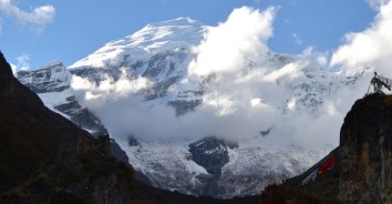
Distance 19 km, 5-6 hours, 480 m ascent, camp altitude 4,080 m. If you did not see Mt. Jomolhari the previous evening, you will still have a chance to get a great view early this morning. This morning the trek continues up the Paro Chhu valley which widens into patches of alpine meadow and sc…
Food
BLD
Accomodation
Tented Camp
Elevation
4080
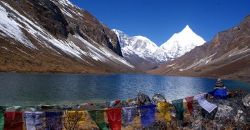
The rest day in Jangothang provides plenty of possibilities for day hikes with great views of lakes and snow capped mountains such as Jomolhari and Jichu Drake. There are good chances to spot some blue sheep on the upper slopes of the valley. Jangothang is a perfect environment for your acclimati…
Food
BLD
Accomodation
Tented Camp
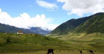
Distance 16km, six to seven hours, 810m ascent, 1,090m descent, camp altitude 3,800m. The trail leads to a last settlement in the valley and drops to the Paro Chhu. Passing the lake of Tshophu (4,380m) you will climb up steeply to Bhonte La pass at 4,890 m, the highest point of this trek rout…
Food
BLD
Accomodation
Tented Camp
Elevation
4890
Distance 11km, four to five hours, 720m ascent, 340m descent, camp altitude 4,180m. The trail climbs 100m over a ridge to drop to another stream then. After crossing the Takhung La pass (4,520m) you descent to Thombu Shong, three yak herder huts with your campsite next to them.
Food
BLD
Accomodation
Tented Camp
Elevation
4520
Distance 13km, four to five hours, 200m ascent, 1,650m descent, camp altitude 2,850m. Crossing Thombu La pass (4,380m) you will finally reach Gunitsawa where you can be collected or you may decide to stay at the campsite, Sharna Zampa, where you stayed the first night of this trek.