.jpg)
Overview And Highlights
TRIP FACTS

Experience the breathtaking beauty and cultural richness of the Langtang Valley and Ganja-La to Helambu Trek, one of the most picturesque trekking destinations in Nepal. Led by Annapurna Encounter, this journey takes you through the traditional villages, and stunning alpine landscapes.
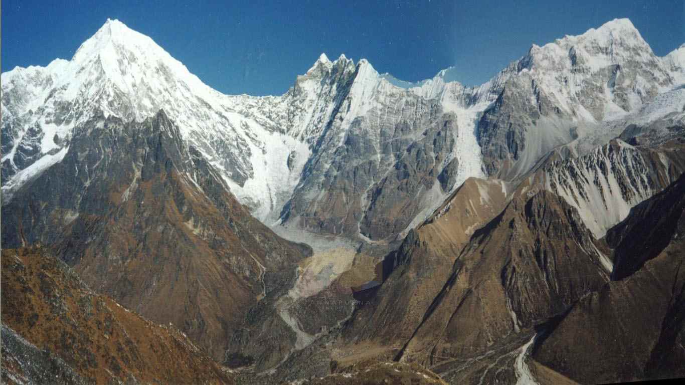
This trek begins in the Langtang Valley, surrounded by towering snow-capped peaks such as Ghengu Liru (6,571m), Langtang Lirung (7,425m), Kimshun (6,745m), and Shalbachum (6,918m). The scenic trail passes through lush forests of rhododendron, pine, magnolia, and fir, leading to Kyanjin Gomba, a spiritual hub with breathtaking views.
The trek continues across the Langtang National Park, Nepal’s first Himalayan park covering 1,710 sq. km, before heading to Ganja-La Pass (4,609m). This high-altitude crossing offers panoramic views of the central Himalayas, including Naya Kanga (5,846m), Gangchempo (Tilman’s Fluted Peak), and the majestic Dorje Lakpa (6,980m).
Highlights of Langtang Valley & Ganja-La to Helambu Trek
- Trek through pristine wilderness and enjoy the tranquility of the Langtang Valley.
- Explore the Tamang Heritage Trail, rich in culture and unique traditions.
- Cross the challenging Ganja-La Pass, offering incredible Himalayan vistas.
- Experience the serene Helambu region with its picturesque woodlands and traditional villages.
- Conclude the adventure with a scenic descent to Sundarijal near the Kathmandu Valley.
Essential Trekking Information
- Duration: 12–14 days
- Maximum Altitude: 4,609 meters (15,100 ft) at Ganja-La Pass
- Trek Grade: Moderate to Challenging
- Best Seasons: Spring (March–May) and Autumn (September–November)
- Permits Required: Langtang National Park Permit and TIMS card
Packing Essentials for Langtang Valley & Ganja-La to Helambu Trek
Packing wisely ensures your safety and comfort during the trek. Below is a checklist of recommended items:
- Clothing: Woolen gloves, thermal socks, woolen jacket or pullover, windproof/waterproof jacket, trekking pants, long-sleeve shirts, and a hat.
- Footwear: Sturdy trekking boots (waterproof), sandals, and spare socks.
- Gear: Trekking poles, sleeping bag, backpack with a rain cover, and headlamp/torch with extra batteries.
- Personal Items: Sunscreen, sunglasses, chapstick, toiletries, travel towel, and a first aid kit.
- Hydration & Food: Water bottle, water purification tablets, and light snacks.
- Electronics: Camera, batteries, power adapter, and chargers.
Why Choose Annapurna Encounter?
With decades of experience, Annapurna Encounter ensures a safe and memorable trekking experience. From expert guides to tailored itineraries, we prioritize your adventure needs. The Langtang Valley and Ganja-La to Helambu Trek is a perfect blend of adventure, culture, and nature, promising memories to last a lifetime.
Langtang Valley & Ganja-la to Helambu trek Cost
| No. of People | Price (per person) |
|---|---|
| 1 | US$ 2000 |
| 2 | US$ 1950 |
| 3-7 | US$ 1900 |
| 8-12 | US$ 1850 |
| 13-20 | US$ 1800 |
Itinerary Expand All Close All
Starting this wonderful journey driving towards North West of Kathmandu passing interesting villages and towns with fabulous scenery of hills, farm terraces and snow capped peaks after the warm area reaching to cooler region at Langtang National Park entrance in Dhunche 1950 meters, the one and the only major town of Rasuwa district and Langtang area, inhabited mostly of Tamang ethnic tribes throughout the area of this trekking.
From here heading downhill for another 2 hours to the fist overnight stop in Langtang area at Syabrubesi the gateway to Langtang, Ganesh and into Tamang Heritage Trail and as well to the Tibet border at Kyarong just 2 hrs of driving distance from this village.
Food
BLD
Accomodation
Lodge
Elevation
1460
The first day walk of this adventure leads to cross a bridge over Langtang Khola (river) later joins the great Trisuli River, and then on the uphill walking through scattered farm villages and terraces with views of surrounding landscapes and into a cool shade of forest reaching near a place with small lodges and tea house at Riverside where the trail from Upper or Thulo Syabru meets, after a rest or lunch break trek continues with a climb through beautiful forests of rhododendron, pines, bamboo tree lines, Langtang area is famous for rare and elusive Red Panda and other wildlife’s, after a good day’s walk reaching at Lama Hotel located in between forest surrounding and by the Langtang Khola with 5-6 simple lodges.
Food
BLD
Accomodation
Lodge
Elevation
2350
Morning walk heads higher up through the river gorge in the middle of enchanting woodlands of tall trees of pines, rhododendron and following the river upstream passing few houses and cattle herders shelters and then to more cooler place at Ghoretabela for lunch break in beautiful forest surrounding with few lodges around. From here another 2-3 hours of good walk and the leaving the tree lines behind reaching at Langtang village for overnight stop, the last village before Kyanjin. Here explore this interesting village of Tamang and Bhotias people of Tibetan origin with similar life style of Tibet religion and culture.
Food
BLD
Accomodation
Lodge
Elevation
3307
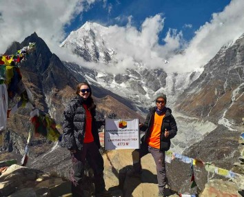
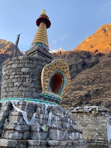
After a wonderful stop in this last village, while other up are temporary settlement of yak herders and lodge to serve the trekkers, moving on the winding up trail and then the gorge opens to a wide beautiful valley with awesome views of snow capped peaks that lines this Langtang valley, walking on encountering few prayer or mani walls and then reaching our first destination of this trip at Kyanjin Gomba for two nights in this lovely valley surrounded by many peaks around with Langtang Lirung glacier just close by from the lodges.
Food
BLD
Accomodation
Lodge
Elevation
3749
A perfect spot for rest day to acclimatize at this high altitude before our next exciting journey to cross over Ganja – La at 5,121 meters pass the highest point of this adventure and beyond, here many places for short hike and climb like to the hill top of Tsego and Kyanjin ri at over 4,000 meters top for better panorama of surrounding mountains.
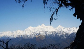
From view point hill overlooking at Langtang Himal, beyond which lies Tibet. The major peaks include Ghengu Liru (Langtang II 6571m / 21,560ft), Langtang Lirung (7,425m / 23,765ft) Kimshun (6,745m / 22,137ft) and Shalbachum (6,918m / 22,699ft) to the south, the Chimsedang Lekh forms a ridge of peaks which includes Naya-Kanga 5,846m and Gangchempo, Tilman\'s beautiful Fluted Peak. Beyond it continues to the Jugal Himal, ending with Dorje Lakpa (6,980m / 22,929ft), extending further east on the upper meadows of the Langtang range ends in a huge and massive mountain wall, forming the border with Tibet.
Food
BLD
Accomodation
Lodge
Elevation
3749
After a nice rest in the beautiful Langtang valley at Kyanjin heading towards our next adventure crossing the Langtang River on a small wooden bridge and then a climb through sparsely wooded forest of birch and smaller trees of rhododendron heading higher to camp at Branchen Kharka a summer pasture for grazing Yaks, this will be the first and for two more nights camping of this trip before reaching at Helambu area on route Kathmandu, this camping beneath the towering peak of Nayakanga also called as Ganja-la peak.
Food
BLD
Accomodation
Lodge
Elevation
4100
From this camp heading higher to establish a high camp close the pass cairn of Ganja-la beneath Nayakanga peak, walk leads on the faint path leaving the trees behind for rocks and moraine continue on the trail to Ganja-La to reach the upper ridge filled by glacier beneath the North-East Face of Nayakanga peak at 5,844 meters high, and then climbing a steep up moraine to set the high camp for last overnight in Langtang area, with tremendous views of all the peaks that this fantastic place has to offer with Mt. Shisapangma within Tibet at 8,013 meters the last world’s 14th highest mountains.
Food
BLD
Accomodation
Tented Camp
Elevation
5100
Today a Big Day! Starting earlier before the break of dawn with slow climbcrossing from right to left on a cairned top of this pass, with a thin glacier on the far side; and then on the downhill (sometime a fix rope is needed for the descend in case of difficulty in snow and ice our expert team of guides will fix ropes where necessary for members to cross safely and for porters and staff as well) to camp by two small glacial ponds on the side of a glacier beneath the moraine covered site. If time and conditions permits reaching here on good time safely, walk 2 hours further to Keldrong Khaka at 4,298 meters.
Food
BLD
Accomodation
Lodge
Elevation
4298
From this campsite starting with lazy morning after the hard activities of previous day, walk leads to a descend on a steep vague trail from the glacier into moraines to Kharka a shelter and camp of cattle herders; this nice spot provides excellent camping site for the last night in tents before
Tarkyeghyang is reached, as this fine place also provides shelters for the porters in a cave of overhanging rocks on the flat valley beneath the glacier looking over the Dukpu Danda hill ridge.
Food
BLD
Accomodation
Lodge
Elevation
4023
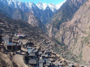
After this last camp in tents, walk leads for an hour to Dupku at 3,993 meters, here crossing the high ridge lined with prayer monuments and chortens at about 4,054 meters ridge top, and then a long downhill walk into Helambu area passing several meadows and nice pastures and reaching back to tree lines with thick vegetation and finally ending the day walk at a nice village in Tarkeghyang, the people of this village although similar sect of Buddhist of Langtang or Khumbu area, the people are of Hyalmo ethnic tribe looking similar to Tamang and Sherpa with the culture, religion and customs.
Food
BLD
Accomodation
Lodge
Elevation
2560
A nice place to have a free day after few days of hard walking, here visit the monastery and explore the neat and pretty houses of this village, Helambu area is famous for apples, there are few orchard around.
Food
BLD
Accomodation
Lodge
Elevation
2560
To complete this journey using a new alternative routes to Timbore a small village, where the newly built motor road has reached recently of few years ago (2012) that connects to Kathmandu and other Helambu area, after a wonderful time at Tarkeghyang walking downhill to Melamchi River to reach Timbore for last overnight stop of this trekking and adventure.
Food
BLD
Accomodation
Lodge
Elevation
1640
From Timbore village morning drive back to Kathmandu on the dirt rough jeep trail for some time and then reaching the main road that connects Kathmandu / Lhasa, Tibet highway and towards Dhulikhel town a scenic spot for mountain views with fine hotels and resorts around. From here an hour scenic drive brings you back to hustle bustle of city life of Kathmandu and back to respective hotels after concluding an adventure of a life time.
Food
BL
Accomodation
Hotel
Elevation
1350
Services Included on Price
Cost Includes
- Accommodation
- Basic tea house/lodge stays during trek (twin-sharing)
- Transport
- Local bus Kathmandu → Syabrubesi (trek start)
- Local bus return from trek ending point → Kathmandu
- Airport pick-up in Kathmandu
- Meals
- Not included – trekkers pay directly at lodges
- Guide & Porter
- Licensed, English-speaking trekking guide
- No porter service (optional at extra cost)
- Permits & Fees
- Langtang National Park Entry Permit
- TIMS card
- Extras
- Pre-trek briefing
- Basic first aid kit with guide
Cost Excludes
- All meals during trek and in Kathmandu
- Hotel accommodation in Kathmandu
- Porter service (optional, extra cost)
- Personal trekking gear (jackets, sleeping bag, poles, etc.)
- Hot showers, Wi-Fi, charging in lodges (extra)
- Travel insurance (mandatory)
- International airfare & Nepal visa fees
- Alcohol, bottled water, snacks
- Tips for guide, porter, driver
- Costs due to delays/weather/natural disasters
Standard Package Service Includes
- Accommodation
- 2 nights in 3★ hotel in Kathmandu with breakfast
- Tea house/lodge stays during trek (twin-sharing)
- Transport
- Tourist bus Kathmandu → Syabrubesi
- Tourist bus return from trek end point → Kathmandu
- Airport transfers in Kathmandu
- Meals
- Breakfast in Kathmandu hotel
- All meals during trek (breakfast, lunch, dinner with tea/coffee)
- Guide & Porter
- Licensed, English-speaking trekking guide
- Porter service (1 porter for 2 trekkers, 15–20 kg)
- Permits & Fees
- Langtang National Park Entry Permit
- TIMS card
- Extras
- Pre-trek briefing
- First aid kit with oximeter
Standard Package Service Excludes
- Lunch & dinner in Kathmandu
- Personal trekking equipment (rentable in Kathmandu)
- Hot showers, Wi-Fi, charging in lodges (extra cost)
- Travel insurance
- International airfare & Nepal visa fees
- Alcohol, bottled water, snacks
- Tips for guide, porter, driver
- Costs due to delays/weather/natural disasters
Luxury Package Service Includes
- Accommodation
- 2 nights in 4–5★ hotel in Kathmandu with breakfast
- Best available lodges during trek (attached bathrooms where available)
- Transport
- Private jeep Kathmandu → Syabrubesi
- Private jeep return from trek end point → Kathmandu
- Luxury airport & city transfers
- Welcome & farewell dinners in Kathmandu
- Meals
- All meals during trek with menu options
- Breakfast in Kathmandu
- Welcome & farewell cultural dinners
- Guide & Porter
- Senior trekking guide (experienced in Ganja La)
- Porter service (20–25 kg per porter)
- Staff insurance included
- Permits & Fees
- Langtang National Park Entry Permit
- TIMS card
- Extras
- Loaner trekking gear (sleeping bag, down jacket, trekking poles)
- Emergency evacuation support (insurance required)
- Daily health monitoring with oximeter
- Optional sightseeing in Kathmandu
Luxury Package Service Excludes
- International airfare
- Nepal visa fees
- Comprehensive travel insurance
- Personal expenses (souvenirs, laundry, phone calls)
- Alcohol, bottled water, soft drinks
- Tips for guide, porter, driver
- Optional upgrades (helicopter, single supplement)
- Costs due to delays/weather/natural disasters
Langtang Valley & Ganja-la to Helambu trek Altitude Profile
FAQs
The difficulty level of the trek is considered to be moderate to challenging, as it involves steep climbs, high altitude, and rugged terrain. Therefore, it is recommended for experienced trekkers or those with good physical fitness.
The best time to do the trek is during the spring (March to May) and autumn (September to November) seasons, as the weather is dry and clear, and the views are breathtaking.
The highlights of the trek include the Langtang Valley, Kyanjin Gompa, Ganja-la pass, and Helambu region, which are all blessed with natural beauty, cultural diversity, and stunning landscapes.
The altitude of the highest point on the trek is 5,122 meters (16,800 feet), which is the Ganja-la pass.
Permits are required for this trek, including a Langtang National Park permit and a TIMS (Trekkers Information Management System) card.
It is generally safe to trek in this region, but it is always advisable to take necessary precautions and hire a licensed guide or porter for safety and convenience.
Accommodation options on the trek include teahouses, lodges and camping, which offer basic facilities such as shared rooms, hot showers, and local food.
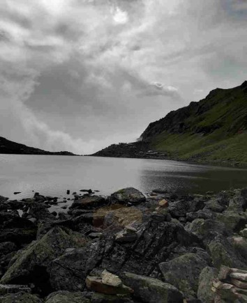
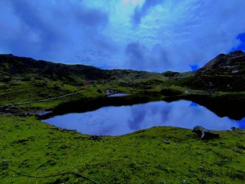
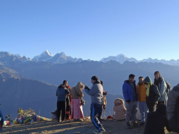
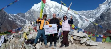
IMAGE GALLERY
_11zon.jpg)
.jpg)