Overview And Highlights
- Based On 1 Review
TRIP FACTS

" a cultural and scenic walks from north west to east within Central Himalaya & Langtang Himal. "
Langtang & Gosainkund trekking, a fabulous journey which leads north of Kathmandu valley with an exciting overland drive to reach at Langtang Himal areas within the district of Rasuwa populated mostly by Tamang tribe of hill people.
An interesting and scenic country within Central Himalaya region which covers Ganesh-Langtang and Jugal Himal range, as walk follows to our main destination towards Langtang valley and over high Gosainkund and East Laurabina-La pass to reach Kathmandu from eastern side of the valley high green hills.
Langtang & Gosainkund trekking, begins with interesting drive past farm villages and towns of Kakani-Trisuli Bazaar to reach at Dhunche town, the door of many treks and adventure around Langtang and Ganesh Himal areas.
From Dunche a prime town of Rasuwa and Langtang areas and heading downhill at Syabrubesi village where our walks starts following a high hills and into a river gorge covered with dense alpine forest, where often wild-life like Red Panda and other animals can be spotted along the walks.
As walk progress with several overnights stops in village lodges and then reaching a scenic Langtang valley surrounded by array of peaks of Langtang Himal, with time at Kyanjin Gompa with magnificent panorama of mountains in the comfort of nice cozy lodge.
Our next adventure leads to nice Tamang villages of Thulo Syabru and Sing Gompa with enchanting woodland of rhododendron-magnolia and pines trees, soon tree lines fades as walk leads to a climb towards our destination at Gosainkund a glacial pond.
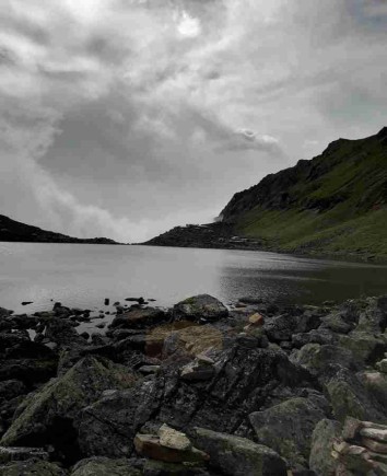
Gosainkund regarded as holy pond where great religious festival takes place once a year in monsoon times of August, great numbers of pilgrims as far from India visits here for a dip in the holy lakes.
With enjoyable and fascinating time at Gosainkund, walk leads to cross a high and scenic pass over Gosainkund and Laurabina-La pass above 4,609 m / 15,209 ft facing views of mountain range, and then heading towards eastern suburb of Kathmandu valley rim hills for the drive back to Kathmandu.
Walk leads ups and down through number of nice farm villages with constant views of Langtang –Ganesh and Jugal mountains with striking sunrise from Chisapani before ending our fabulous walks with an adventure of a lifetime experience on Langtang & Gosainkund Trekking.
Highlights Of Langtang Valley & Holy Gosainkund Trek
- Grand panorama of snow capped around scenic Langtang valley & Holy Gosainkund
- Exploring impressive cultural and traditional farm villages of Tamang tribes of great interest
- Walking into enchanting forest covered with tall rhododendron and magnolia tree lines
- Daily views of mountains in the country where rare and endangered Red Panda inhabits
- From high ridges of Langtang valley and over scenic Gosainkund & Laurabina-la pass
Best Season For Langtang Valley Trek
Spring ( March to May)
- In lower altitudes, daytime temperatures range from 10°C to 20°C (50°F to 68°F), while higher elevations can get chilly, dropping to 0°C to 10°C (32°F to 50°F) at night.Spring provides clear skies and excellent visibility, making it a superb time for photography.The rhododendron forests burst with vibrant colors, creating a stunning backdrop.Enjoy pleasant trekking conditions with warm days and cool nights.The clear skies ensure unobstructed views of snow-capped peaks.Spring is perfect for botany enthusiasts due to the variety of blooming flora.
Autum (September to November)
- Enjoy pleasant daytime temperatures between 10°C to 20°C (50°F to 68°F) in lower altitudes. Higher up, it cools down, ranging from 0°C to 10°C (32°F to 50°F) at night. Autumn offers crystal-clear skies, providing excellent mountain views.Dry and stable conditions for comfortable trekking. Exceptional views of the Langtang peaks and surrounding landscapes.Opportunities to experience local festivals, adding a cultural dimension to your journey.Ideal conditions for capturing breathtaking photographs.
Winter ( December to February)
- Cold temperatures, especially at higher elevations. Daytime temperatures range from 5°C to 10°C (41°F to 50°F) in lower altitudes, dropping below freezing at night.Clear skies with occasional morning mist. Enjoy a quieter trek with fewer fellow travelers.Cold, dry air provides clear and sharp mountain vistas.Trekking in snow-covered landscapes adds a special allure.Lower accommodation and service costs due to fewer tourists.
Monsoon ( June to August )
- Daytime temperatures range from 15°C to 25°C (59°F to 77°F) at lower altitudes, with milder nights that can still be cool.During the monsoon season, there is frequent rain, fog, and cloudy weather, which can limit visibility.The landscape is lush and vibrant, with waterfalls in full flow. Enjoy a quieter trek with fewer fellow travelers on the trail.Opportunities to engage with locals and learn about their way of life.
Equipments
The next details will provide you with a basic understanding of what you should carry for the trek. It's crucial not to overlook the necessary items, as they will impact your comfort and safety during the hike. It's just as vital not to weigh yourself down with unnecessary gear during the trek.
-
A pair of half-golves
- A pair of Woolen shocks
- A wool jacket or pullover, Water and Windproof shell jackets
- long sleeve t-shirts
- Windproof and Waterproof Trousers (warmer), Comfortable trekking pants
- Water Trekking Boots/ Pair of sandals
- First Aid kits and Medicine
- Backpack with rain cover
- Water Bottle
- Headlamp or torch
- Sunscreen / Sunglasses / Sunhat
- Sleeping bag
- Trekking Poles
- Chapstick
- Camera & Batteries
- Power adapter and chargers
- Travel Towel
- Toiletries
Langtang Valley & Holy Gosainkunda Trek Cost – 12 Days – Group Pricing (Per Person in USD)
| Group Size | Budget Package | Standard Package | Premium Package |
|---|---|---|---|
| 1 Person (Solo) | $590 | $990 | $1,690 |
| 2 People | $560 | $930 | $1,560 |
| 3–7 People | $530 | $880 | $1,460 |
| 8–12 People | $500 | $840 | $1,360 |
| 13–20 People | $470 | $800 | $1,260 |
✅ Budget = made affordable (local buses, tea houses, guide only, no meals).
✅ Standard = best value (meals, porter, 3★ hotels, tourist bus).
✅ Premium = private jeeps, best lodges, luxury hotels, more services.
Itinerary Expand All Close All
Morning traveling by coach or in private vehicles (depending upon group size), where drive leads on interesting and exciting highway to reach at Dhunche and beyond to Syabrubesi village.
On drive views of mountain and scenic landscapes as journey leads past number of farm villages and towns and then ending the drive at Syabrubesi for first overnight stop, around Langtang Himal and Rasuwa district home of Tamang the mountain tribe of Nepal and Langtang areas.
Food
BLD
Accomodation
Lodge
Elevation
1950
First day walk from Syabrubesi, leads to a climb for a while with rest of the walk on gradual winding uphill trail through terraced farm fields and villages.
As our route enters into cool forested area in a gorge following the torrential glacial Trisuli River upstream, as the path follows with a climb in the cool shade of rhododendron and oaks forest after a good walk of near six hours reaching a small clearing at Lama-Hotel for overnight stop.
Food
BLD
Accomodation
Lodge
Elevation
2200
From here few hours of morning walks leads to Ghoretabela for possible lunch stop within lovely forest of pines, hemlocks and rhododendron from here onwards you can feel the altitude also.
After a refreshing break, walk continues on the road to beautiful Langtang valley, an hour treks into a pleasant cool alpine woodland, crossing a small stream leaving tree line behind as our walk leads uphill for an hour, then walk gets easier on gradual trail with few ups and down to Langtang village for overnight stop.
Food
BLD
Accomodation
Lodge
Elevation
3307
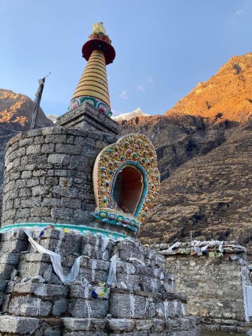
From Langtang village walking on nice gradual uphill trail for few hours following “mani-prayer wall” where walking clockwise is the appropriate way in respect to Buddhist religion, walk leads further east as valley opens up with views of snow capped peaks.
After hours of gentle good walk overlooking views of peaks brings you at Kyanjin Gompa a charming and scenic spot with amazing views of Langtang Lirung above 7,000m and its icefall at near distance Kyanjin Gompa, surrounded by a ridge formed by glacial moraine of rocks and boulders.
Food
BLD
Accomodation
Lodge
Elevation
3750
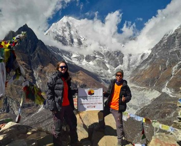
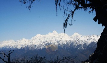
A leisure day, visit Kyanjin small Cheese factory with optional hike up to Tsego-Ri or Kyngin Ri above 4,700 m / 15,420ft adding more heights facing stunning panorama of snow capped mountains from Langtang Himal, Ganesh Himal (7,405 m), Langtang Lirung (7,234 m), Ghengu Liru (Langtang II 6,571m), Kimshun (6,745 m) and Shalbachum(6,918m), Chimsedang, Naya-Kanga or Ganja Chuli (5,846m), Gangchempo, Tilman's beautiful Fluted Peak, Jugal Himal and ending to eastern horizon at Dorje Lakpa (6,980m).
Food
BLD
Accomodation
Lodge
Elevation
3750
After a refreshing and pleasant scenic time at Kyanjin, our walk retracing the trail back on same route to Lama-Hotel a small settlement in the midst of the forest at the bank of upper Trisuli River.
Food
BLD
Accomodation
Lodge
Elevation
2350
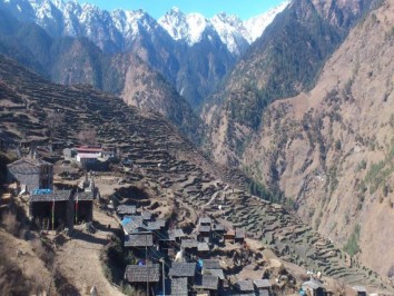
Morning our route diverts towards Gosainkund holy pond as walk leads on the same trail for a while and then uphill climb past a place called Bamboo with few lodges and Tea-House to reach a high ridge at Upper or Thulo Syabru.
A nice Tamang village where series of houses perched on a ridge top with an old monastery above the village, overnight in this lovely village with time for local exploration.
Food
BLD
Accomodation
Lodge
Elevation
2118
Morning walk leads uphill on winding path above monastery gaining more height facing views of Ganesh-Himal, Manaslu, Langtang and Annapurna range towards far west, after a few refreshing stops at teahouses on route, journey continues with an hour uphill from the farmlands and into cool alpine forest and then reaching at Sing Gompa for overnight stop near its old monastery.
Food
BLD
Accomodation
Lodge
Elevation
3254
Trek today offers more views of snow clad peaks of Langtang to the north and Ganesh-Himal range towards north west along with Manaslu and Annapurna range, walk leads to gradual up for an hour entering oaks, pines and rhododendron forest, after a brief stops with grand views, walk continues on uphill trail leaving tree lines and green vegetation behind for dwarf rhododendron, juniper and alpine shrubs bushes.
The path unwinds uphill passing through few teahouses at Laurabina, means a place with walking sticks, (on auspicious time in August with full moon as per the Nepali Luna calendar, the pilgrims visits Gosainkund pond for ritual bathe and dip belief it delivers one into paradise and drink of its holy water relinquishes the sins of a hundred lifetimes) Hindu pilgrims leaves their walking stick here so the name Laurabina.
From here short descend and up reaching across Saraswati and Bhiarav kund after a small climb brings you to our overnight stop at Gosainkund near its pristine pond. Here you can see lots of traces left behind by the pilgrims.
Food
BLD
Accomodation
Lodge
Elevation
4381
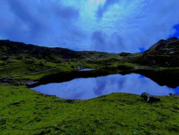
From Gosainkund a gradual walk on a small path along pond, and then climb near a small creek in between rocks and boulders, as the walk leads close to a small pond of Surjakund the trail here is more gradual with winding up to Gosainkund pass or East Laurabina La the highest spot of the adventure.
After the top, a long descend to Phedi (bottom) at 3,694 m few teahouses, a possible lunch stop and then our journey continues east towards Helambu region and back into green vegetations of junipers, rhododendron and then reaching at Ghopte (meaning overhanging rocks) for overnight stop.
Food
BLD
Accomodation
Lodge
Elevation
3566
After walking around complete wilderness, walk from here trails joins of Helambu and Kathmandu; trek is pleasant into forest for an hour, with an hour uphill to Tharepati 3,597m.
A nice spot situated on a ridge overlooking views of peaks with Jugal Himal range and Ganesh-Manaslu towards west.
From here descend to Mangeghot, a nice place with grassy field, and the walk back into farm fields at Kutumsang for overnight stop, this village with Sherpa, Hyalmo and Tamang hill tribes.
Food
BLD
Accomodation
Lodge
Elevation
2445
Today a long day walk to reach at Chisapani, as morning leads on winding path with few ups and downhill walks passing many rural farm areas and villages to reach at Gul-Bhanjyang located on a ridge top. After a refreshing break continues walk on nice and pleasant trail past farm villages to reach at a nice Pati Bhanjayang village, from this village with short climb to our last overnight stop at Chisapani, a nice and scenic small village close located north of Kathmandu Valley rim.
A scenic spot for stunning sunrise views over mountain range from Jugal Himal range towards north east and Ganesh Himal-Manaslu and Annapurna range towards west.
Food
BLD
Accomodation
Lodge
Elevation
2195
Our last day of trekking of this wonderful adventure, morning catching the views of stunning sunrise over array of peaks, walk downhill past number of Tamang farm village to reach at Sundarijal town.
From here taking an hour drive back to Kathmandu past Jhorpati and great Bouddhanath Stupa to reach your hotel, with time in the afternoon for individual activities shopping souvenirs or join in for another exciting sightseeing tour.
Food
Breakfast
Accomodation
Hotel
Elevation
1350
Services Included on Price
Cost Includes
-
Accommodation
- Tea house/lodge stays during trek (basic, twin-sharing)
-
Transport
- Local bus Kathmandu → Syabrubesi (trek start)
- Local bus Dhunche → Kathmandu (return)
- Airport pick-up in Kathmandu
-
Meals
- Not included – trekkers pay directly at lodges
-
Guide & Porter
- Licensed, English-speaking trekking guide
- No porter service (optional, extra cost)
-
Permits & Fees
- Langtang National Park Entry Permit
- TIMS card
-
Extras
- Pre-trek briefing
- Basic first aid kit with guide
Cost Excludes
- Lunch & dinner in Kathmandu
- Personal trekking equipment (rentable in Kathmandu)
- Hot showers, Wi-Fi, charging in lodges (extra cost)
- Travel insurance
- International airfare & Nepal visa fees
- Alcohol, bottled water, snacks
- Tips for guide, porter, driver
- Costs due to delays/weather/natural disasters
Standard Package Service Includes
-
Accommodation
- 2 nights in 3★ hotel in Kathmandu with breakfast
- Tea house/lodge stays during trek (twin-sharing)
-
Transport
- Tourist bus Kathmandu → Syabrubesi
- Tourist bus Dhunche → Kathmandu
- Airport transfers in Kathmandu
-
Meals
- Breakfast in Kathmandu hotel
- All meals during trek (breakfast, lunch, dinner with tea/coffee)
-
Guide & Porter
- Licensed, English-speaking trekking guide
- Porter service (1 porter for 2 trekkers, 15–20 kg)
-
Permits & Fees
- Langtang National Park Entry Permit
- TIMS card
-
Extras
- Pre-trek briefing
- First aid kit with oximeter
Standard Package Service Excludes
-
Lunch & dinner in Kathmandu
-
Personal trekking equipment (rentable in Kathmandu)
-
Hot showers, Wi-Fi, charging in lodges (extra cost)
-
Travel insurance
-
International airfare & Nepal visa fees
-
Alcohol, bottled water, snacks
-
Tips for guide, porter, driver
-
Costs due to delays/weather/natural disasters
Luxury Package Service Includes
-
Accommodation
- 2 nights in 4–5★ hotel in Kathmandu with breakfast
- Best available lodges during trek (attached bathrooms where available)
-
Transport
- Private jeep Kathmandu → Syabrubesi
- Private jeep Dhunche → Kathmandu
- Luxury airport & city transfers
- Welcome & farewell dinners in Kathmandu
-
Meals
- All meals during trek with wider menu options
- Breakfast in Kathmandu
- Welcome & farewell cultural dinners
-
Guide & Porter
- Senior trekking guide (Langtang region specialist)
- Porter service (20–25 kg per porter)
- Staff insurance included
-
Permits & Fees
- Langtang National Park Entry Permit
- TIMS card
-
Extras
- Loaner trekking gear (sleeping bag, down jacket, trekking poles)
- Emergency evacuation support (insurance required)
- Daily health monitoring with oximeter
- Optional sightseeing in Kathmandu
Luxury Package Service Excludes
- International airfare
- Nepal visa fees
- Comprehensive travel insurance
- Personal expenses (souvenirs, laundry, phone calls)
- Alcohol, bottled water, soft drinks
- Tips for guide, porter, driver
- Optional upgrades (helicopter, single supplement)
- Costs due to delays/weather/natural disasters
Langtang Valley & Holy Gosainkund Trek Altitude Profile
FAQs
The best time to do the Langtang Valley and Holy Gosainkund Trek is from March to May and from September to December, when the weather is mild and the skies are clear.
The trek is moderate in difficulty and suitable for trekkers with a good level of fitness. However, there are some steep sections and high altitudes, so it's important to be well-prepared and acclimatize properly.
The highest altitude reached on the trek is around 4,600 meters at the top of the Laurebina Pass.

_11zon.jpg)
_11zon.jpg)
.jpg)
Dustin Hasberg
Germany
Amazing First Trekking Experience with Annapurna Encounter
20th January, 2025
Quite spontaneously I traveled to Kathmandu as a solo traveler and knew that I really wanted to do a trek in the Himalayas. I myself have never hiked for several days, with an overnight stay in huts on the way. It was also January and therefore winter in Nepal.
By chance I came across Anapurna Encounter and found myself quite quickly in the travel agency and opposite Chef Subas. All of my questions were answered competently and patiently and finally I decided to go for the rather simple Langtang Trek with a detour to Lake Gosaikunda.
It should start the next day and just three hours after booking I met Guide Tonka, who went shopping with me and gave me competent advice on everything I needed. I also got a bigger backpack from him because mine was too small.
From that point on, everything was super organized. From the bus ride to the starting point to the return trip to Kathmandu, I was always able to rely on Tonka and Subas also regularly reported whether everything was ok.
The trek itself was beautiful and the contact with the locals in the tea houses was always wonderful. I personally found the tour challenging and some days really asked me to do everything, especially when we were up to 4,700m away. Here I would definitely advise inexperienced hikers to take at least one or even two days off to simply enjoy nature and also to regenerate. I myself scheduled a break day.
The tour was otherwise perfectly organized. There were no hidden costs and Tonka was also a great guide, with whom I could often talk about a wide variety of topics in the evening and learned a lot about Nepalese culture.
When I returned I even received a really nice farewell gift and I was invited to dinner in the restaurant next door.
Since I liked the contact so much, I also booked a flight over the Himalayas, which also went smoothly.
Even after the booked activities, I kept in touch with Tonka and Sibas and was able to contact me at any time with any questions etc.
An absolute recommendation from me!